Back Tiensjan Afrikaans جبال تيان شان Arabic جبال تيان شان ARZ Tian Shan AST Tyanşan Azerbaijani تانری داغلاری AZB Тәңре-Тау Bashkir Tian Shan BCL Цянь-Шань Byelorussian Тяншан Bulgarian
This article may require copy editing for grammar, style, cohesion, tone, or spelling. (July 2023) |
| Tian Shan 天山 | |
|---|---|
| Tengri Tagh, Tengir-Too | |
 The Tian Shan range on the border between China, Kazakhstan and Kyrgyzstan with Khan Tengri (7,010 m) visible at center | |
| Highest point | |
| Peak | Jengish Chokusu |
| Elevation | 7,439 m (24,406 ft) |
| Coordinates | 42°02′06″N 80°07′32″E / 42.03500°N 80.12556°E |
| Geography | |
| Countries | China, Kazakhstan, Kyrgyzstan, Uzbekistan and Tajikistan |
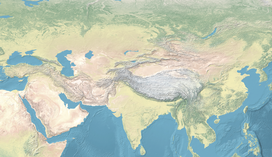
| Range coordinates | 42°N 80°E / 42°N 80°E |
| Geology | |
| Age of rock | Mesozoic and Cenozoic |
| Official name | Xinjiang Tianshan |
| Type | Natural |
| Criteria | vii, ix |
| Designated | 2013 (37th session) |
| Reference no. | 1414 |
| Region | Asia |
| Official name | Western Tien-Shan |
| Type | Natural |
| Criteria | x |
| Designated | 2016 (40th session) |
| Reference no. | 1490 |
| Region | Asia |
The Tian Shan (Chinese: 天山),[note 1] also known as the Tengri Tagh[1] or Tengir-Too,[2] meaning the "Mountains of God/Heaven", is a large system of mountain ranges in Central Asia. The highest peak is Jengish Chokusu at 7,439 metres (24,406 ft) high. Its lowest point is the Turpan Depression, which is 154 m (505 ft) below sea level.[3]
One of the earliest historical references to these mountains may be related to the Xiongnu word Qilian (traditional Chinese: 祁連; simplified Chinese: 祁连; pinyin: Qílián), which, according to Tang commentator Yan Shigu, is the Xiongnu word for "sky" or "heaven".[4] Sima Qian, in the Records of the Grand Historian, mentioned Qilian in relation to the homeland of the Yuezhi, and the term is believed to refer to the Tian Shan rather than the range 1,500 kilometres (930 mi) further east now known as the Qilian Mountains.[5][6] The name of the Tannu-Ola mountains in Tuva has the same meaning. The Chinese name Tian Shan is most likely a direct translation of the traditional Kyrgyz name for the mountains, Teñir Too.[1]
The Tian Shan is sacred in Tengrism. Its second-highest peak is known as Khan Tengri, which may be translated as "Lord of the Spirits".[7] At the 2013 Conference on World Heritage, the eastern portion of Tian Shan in western China's Xinjiang Region was listed as a World Heritage Site.[8] The western portion in Kazakhstan, Kyrgyzstan, and Uzbekistan was then listed in 2016.[9]
Cite error: There are <ref group=note> tags on this page, but the references will not show without a {{reflist|group=note}} template (see the help page).
- ^ a b Prichard, James (1844). History of the Asiatic Nations. Vol. IV (3rd ed.). p. 281.
- ^ "Ensemble Tengir-Too". Aga Khan Trust for Culture. Archived from the original on 5 July 2019. Retrieved 5 July 2019.
- ^ Cite error: The named reference
readersnaturalwas invoked but never defined (see the help page). - ^ 班固 (2015-08-20). 漢書: 顏師古註 Hanshu: Yan Shigu Commentary. Archived from the original on 2023-01-14. Retrieved 2016-09-10.
祁連山即天山也,匈奴呼天為祁連 (translation: Qilian Mountain is the Tian Shan, the Xiongnu called the sky qilian)
- ^ Liu, Xinru (Fall 2001), "Migration and Settlement of the Yuezhi-Kushan: Interaction and Interdependence of Nomadic and Sedentary Societies", Journal of World History, 12 (2): 261–291, doi:10.1353/jwh.2001.0034, S2CID 162211306
- ^ Mallory, J. P. & Mair, Victor H. (2000). The Tarim Mummies: Ancient China and the Mystery of the Earliest Peoples from the West. London: Thames & Hudson. p. 58. ISBN 978-0-500-05101-6.
- ^ Wilkinson, Philip (2 October 2003). Myths and Legends. Stacey International. p. 163. ISBN 978-1900988612. Archived from the original on 14 January 2023. Retrieved 11 September 2016.
- ^ "新疆天山成功申遗". Archived from the original on 2013-06-27. Retrieved 2013-06-22.
- ^ "Western Tien-Shan". UNESCO World Heritage Centre. United Nations Educational, Scientific and Cultural Organization. Archived from the original on 7 July 2018. Retrieved 17 July 2016.
© MMXXIII Rich X Search. We shall prevail. All rights reserved. Rich X Search

